| Activity news VHO |
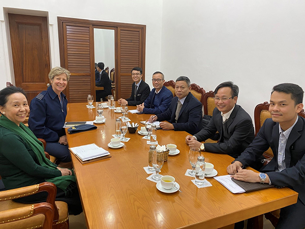
The delegation of the Vietnam Hydrographic Office worked with the British Defense Attaché in Vietnam on the field of Hydrography |
|
| Đăng 20/01/2021; xem 565 lượt; | |
|
The delegation of the Vietnam Hydrographic Office worked with the British Defense Attaché in Vietnam on the field of Hydrographics At the meeting, the two sides exchanged contents to promote the implementation of the Agreement on hydrographic cooperation between the Vietnam People's Navy and the United Kingdom Hydrographic Office (UKHO) signed in 2013 and the Memorandum of Understanding on the implementation of the contents of the hydrographic cooperation agreement signed in 2015, in which the two Parties focused on discussing the exchange of chart data; supporting experts and training hydrographic staff. The two sides have agreed to jointly develop an Action Plan to more effectively implement the signed contents.
The delegation of the Office of the Vietnam Hydrographic Office discussed with the UK Defense Attaché on the field of hydrography Speaking at the meeting, Senior Captain Vo Sy Hien highly appreciated the British Defense Attaché's interest in hydrographic cooperation between the Vietnamese Navy and UKHO; wishes to continue to receive support from the British side in the evaluation of Vietnamese-made charts in order to further improve the quality of Vietnam's charts, to meet the standards of the International Hydrographic Organization; especially support in the field of training experts handling hydrographic data and training courses on hydrography organized by the British Ministry of Defense. At the meeting, the British Defense Attaché noted the proposals of the Vietnamese side; promised to discuss with the British authorities and announce the results soon to the Vietnamese side.
Nguyen The Long |
Other related news
Other news
-
 Simplify administrative procedures on surveying and cartography to create favorable conditions for people and businesses (00:00, 13/09/2021)
-
 Develop regulations on sharing and common use of cartographic data (00:00, 13/09/2021)
-
 Using unmanned aerial vehicles to create topographic maps The Institute of Geodesy and Cartography has researched and widely applied unmanned aerial vehicles (UAVs) to serve the work of making large- (00:00, 13/09/2021)
-
 Finalize the draft Strategy for the development of surveying and cartography industry (00:00, 13/09/2021)
-
 Hydrographic and Oceanographic Division, the Naval Staff Department held the 1st Good Squad Leader Contest, 2021. (00:00, 11/10/2021)


