| Activity news VHO |
Electronic charts of Vietnam in the international market |
|
| Đăng 10/03/2021; xem 1862 lượt; | |
|
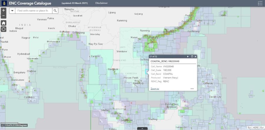
The Online Charts Catalogue are regularly updated on the website of the International Hydrographic Organization (IHO) maintained and updated by the IHO Secretariat, at iho.int/en/iho-online-catalogues. Charts are available from a variety of sources, such as Regional Electronic Chart Coordination Centers (RENCs) or IHO Member States and other organisations. On July 19, 2017, the Vietnam Hydrographic Office (VHO) and the Norwegian Hydrographic Service (NHS) signed the "Agreement between the Vietnam Hydrographic Office (VHO) and the Norwegian Hydrographic Service (NHS) on the operation of the Regional Electronic Chart Coordination Center (RENC)”. On November 5, 2019, the Norwegian Hydrographic Service (NHS) officially released the charts produced by VHO to the international market. According to the statistics of the Regional Electronic Chart Coordination Center (RENC), as of December 31, 2020 the Regional Electronic Chart Coordination Center (RENC) has successfully completed the transaction 20,303 cells with VHO electronic chart cells.
On March 3, 2021, on IHO's website, there was a list of electronic charts in the East Sea area produced by VHO. Currently, VHO is maintaining and actively coordinating with the NHS to add and update new versions of electronic charts within the framework of the signed cooperation agreement to improve the quality of electronic charts. user. Tran Van Hieu |
Other news
-
 The delegation of the Vietnam Hydrographic Office worked with the British Defense Attaché in Vietnam on the field of Hydrography (00:00, 20/01/2021)
-
 Simplify administrative procedures on surveying and cartography to create favorable conditions for people and businesses (00:00, 13/09/2021)
-
 Develop regulations on sharing and common use of cartographic data (00:00, 13/09/2021)
-
 Using unmanned aerial vehicles to create topographic maps The Institute of Geodesy and Cartography has researched and widely applied unmanned aerial vehicles (UAVs) to serve the work of making large- (00:00, 13/09/2021)
-
 Finalize the draft Strategy for the development of surveying and cartography industry (00:00, 13/09/2021)


